Digital Humanities:
The application of computational tools and methods to traditional humanities disciplines such as literature, history, and philosophy.A curated collection of digital humanities projects, tools, and resources to give a sense of the innovative work being done in the field.Summaries are direct quotes from the project websites if available and not too long. Otherwise, a manually written summary is provided.
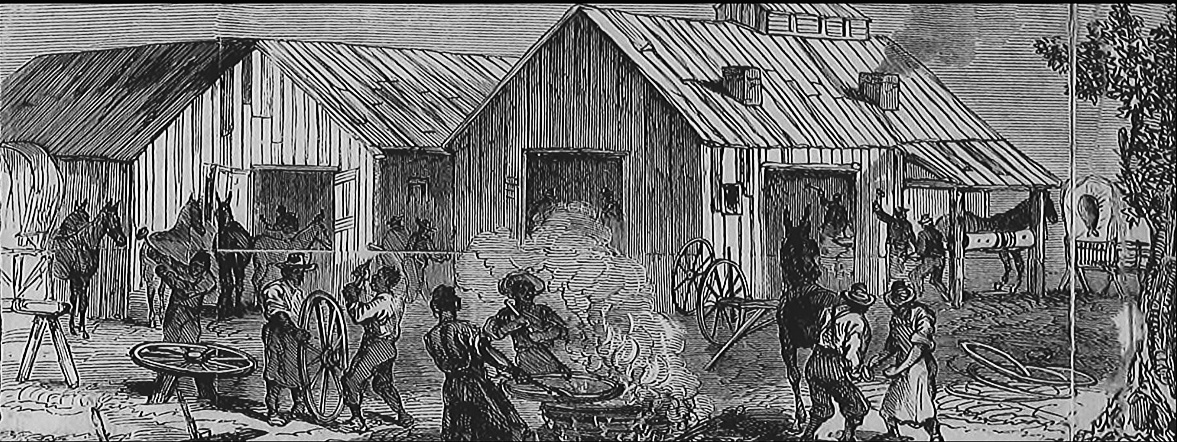
The Black Craftspeople Digital Archive seeks to enhance what we know about Black craftspeople by telling both a spatial story and a historically informed story that highlights the lives of Black craftspeople and the objects they produced
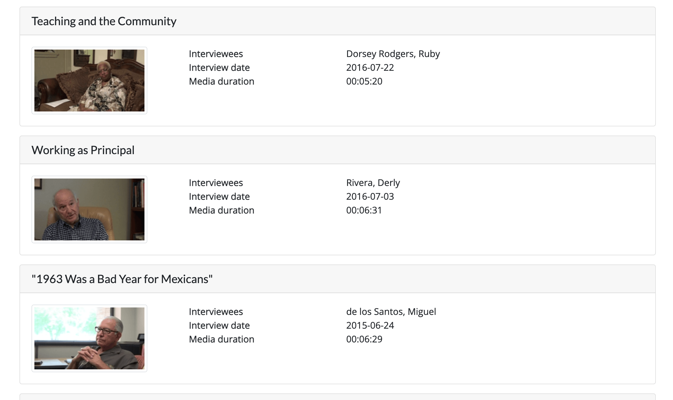
This digital collection gathers interviews with individuals involved in Texas’s civil rights movements. It places emphasis on firsthand accounts to reveal a picture of local struggles for equity.
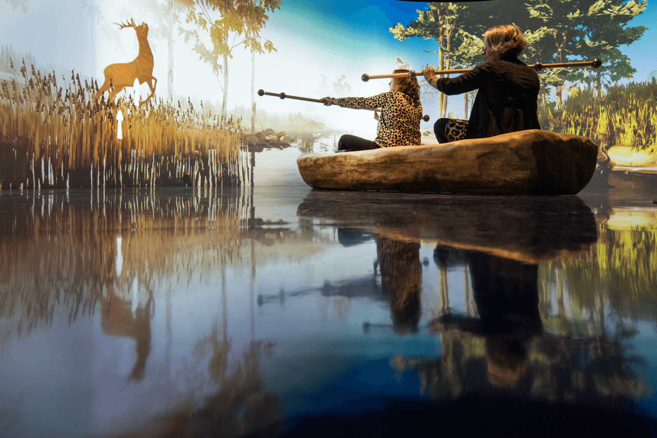
The new Drents Museum offers an interactive journey through time - from hunting mammoths with Neanderthals to dancing at farmers' weddings and canoeing through prehistoric landscapes. Visitors can wander through the Labyrinth of fifteen galleries, each of which presents them with a new world.
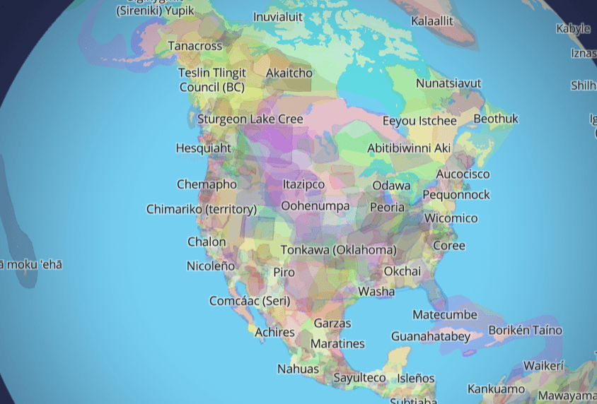
For Native Land Digital, what we are mapping is more than just a flat picture. The land itself is sacred, and it is not easy to draw lines that divide it up into chunks that delineate who “owns” different parts of land. In reality, we know that the land is not something to be exploited and “owned”, but something to be honoured and treasured. However, because of the complexities of history, the kind of mapping we undertake is an important exercise, insofar as it brings an awareness of the real lived history of Indigenous peoples and nations in a long era of colonialism.
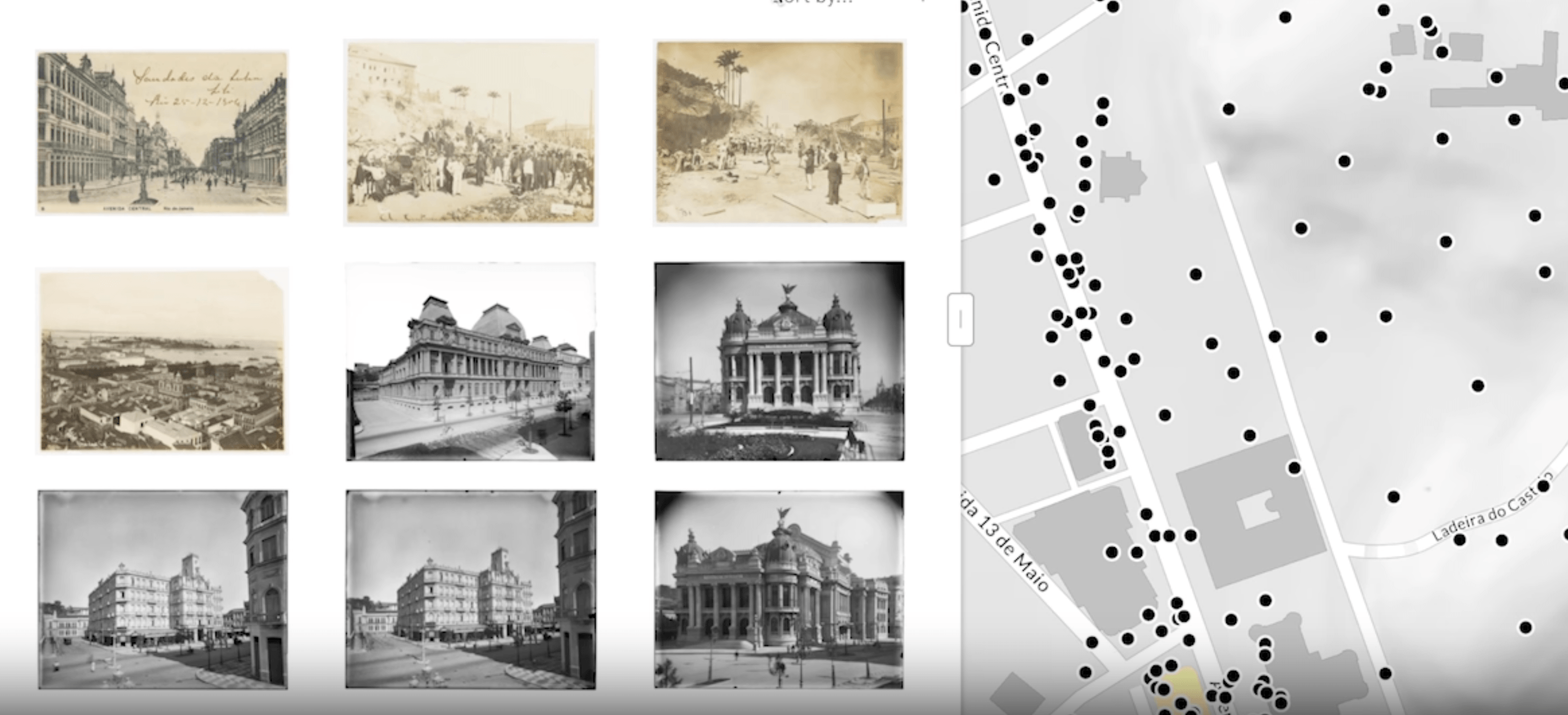
A searchable digital atlas that illustrates the social and urban evolution of Rio de Janeiro, as it existed and as it was imagined.

Work on texts and images. Identify and mark named entities. Use your data in other tools or connect to other data on the Web. Without the need to learn code.
An interactive digital publication and archive of letters, telegrams, and petitions sent to Mississippi's governors between 1859-1882. High-resolution scans and connected tags let users explore networks of people, events, and places that shaped the state during the Civil War and Reconstruction eras

A browser-based application for Latent Dirichlet Allocation (LDA) topic modeling
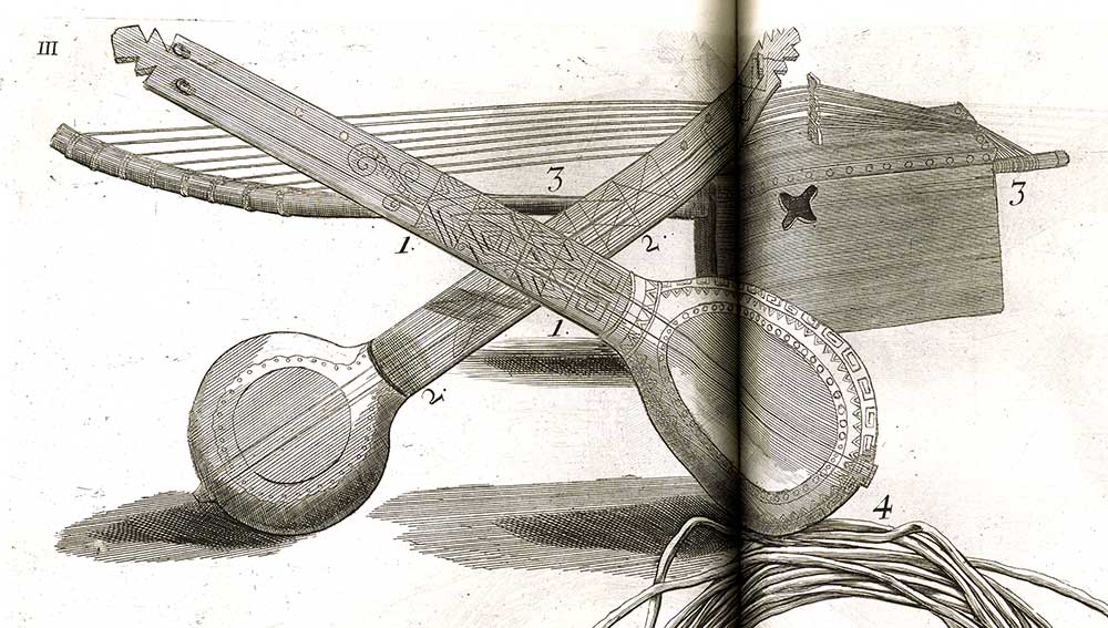
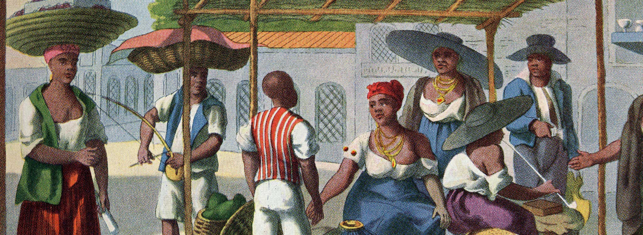
revolutionized global music, but historical records tell us far too little about their earliest practices. In this site we offer a careful interpretation of a single rare artifact, from Hans Sloane's 1707 Voyage to the Islands of Madera, Barbados, Nieves, S. Christophers and Jamaica. Tucked away in this centuries-old book, are several pieces of music that make it possible to hear echoes of performances long past.
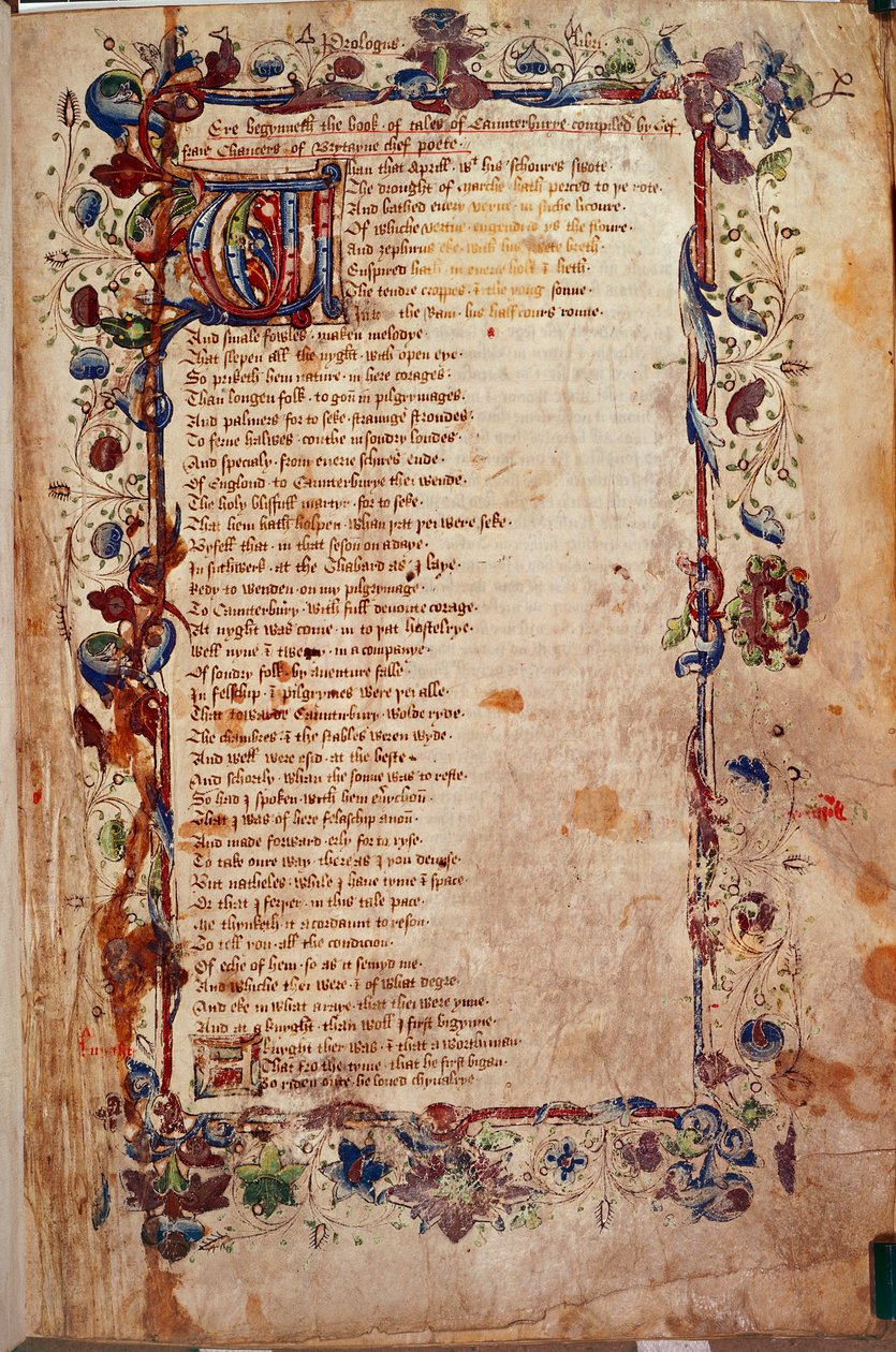
A free web-based scholarly edition of Geoffrey Chaucer’s General Prologue to The Canterbury Tales, CantApp offers a new Middle English text, modern translation, scans of the original manuscript, and audio recordings
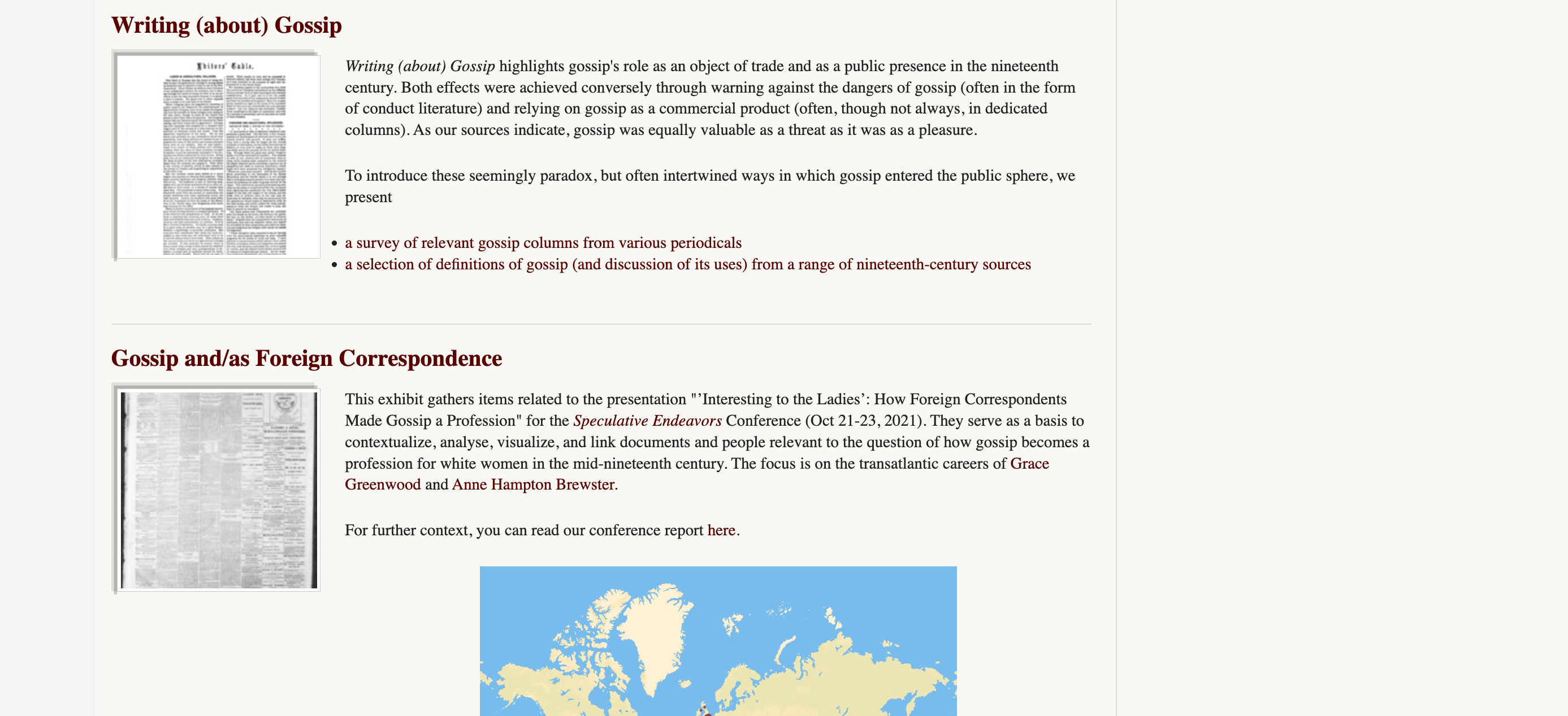
ArchivalGossip offers an innovative approach to understanding gossip as a creative social tool rather than a mere personal indulgence through a rich collection and interactive features such as timelines and maps, the project allows users to explore the role of gossip in history.
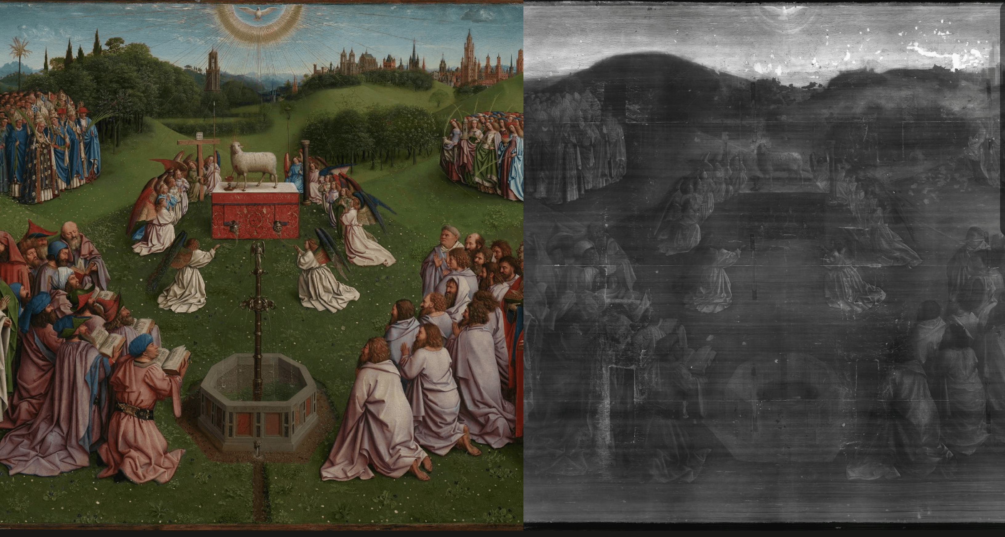
The site allows users to study the painting in regular light, infrared reflectography (IRR), and x-radiography, and zoom into its many details before, during, and after conservation treatment. Closer to Van Eyck set new standards for conservation treatment documentation by providing access to the decision-making process for the treatment of the altarpiece and by disseminating the open-source technology behind the website to the museum community.
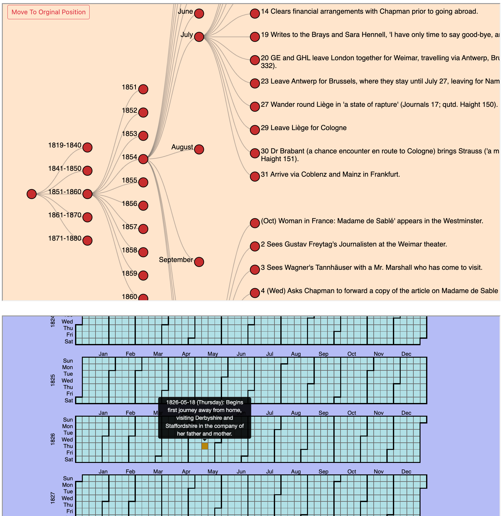
Offers comprehensive access to Mary Ann Evans’s (George Eliot’s) works and related 19th-century reviews, translations, and portraits. Contains interactive visualizations, timelines, and maps, and is designed to support research and teaching on Eliot’s life and works.

The project uses GIS to map James Baldwin's literary references to Paris, offering a unique visual and analytical tool for exploring the geographical influences on his work. It features layers that trace character paths from Baldwin's novels, providing insights into the dynamics of his narratives.
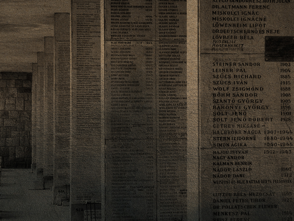
Let them Speak is the epigraph of this digital monograph and the name of the collaborative project between three institutions that gave rise to it. Let them Speak is symbolic; it expresses my intention to give voice to millions of murdered Holocaust victims, to the Drowned, as Primo Levi, the Italian writer and Holocaust survivor, named them. In Search of the Drowned is a hybrid publication with various components bringing together survivors’ testimonies, digital history, computer science, philosophy, and personal memory.
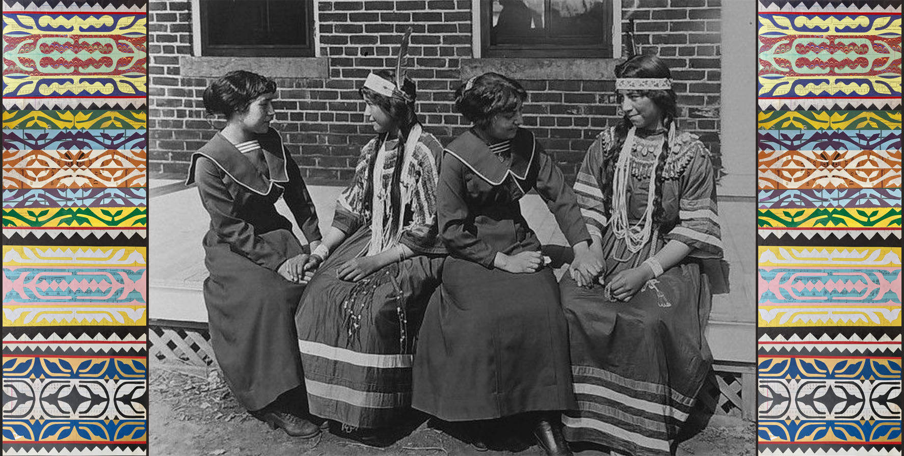
A collaborative venture to recover the stories of Native children who attended the Genoa Indian School between 1884 and 1934. Digitized records—from student files to letters—are presented in partnership with descendant communities to encourage healing and remembrance.
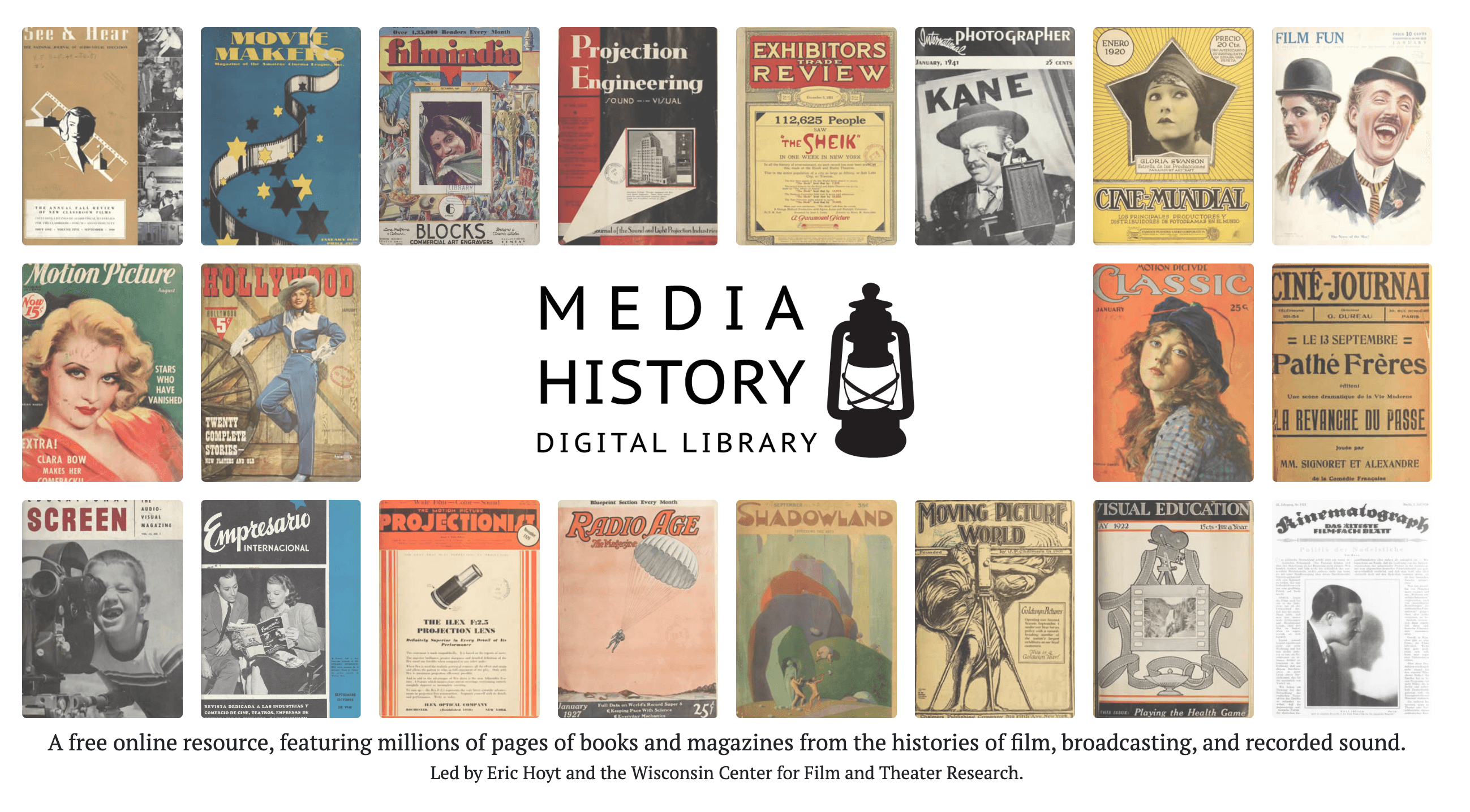
A free online resource, featuring millions of pages of books and magazines from the histories of film, broadcasting, and recorded sound
This Atlas seeks to bring together diverse ways of perceiving, understanding, and responding to nuclear legacies. It contextualizes geographic sites with archival images, illustrations, and other types of content, and is designed as much for browsing as searching, offering both ready retrieval of information and opportunities for serendipitous insight. Issue briefs address nuclear history, policy, governance, and geological and environmental factors. Essays offer scholarly insights into these legacies, drawing out complexity and illuminating continuing controversies. Pushing back against the tendency of policy and academic research toward abstraction, the Atlas includes personal narratives and artistic responses that locate the nuclear in lived, material, and sensory experience. Finally, almost every piece of content appears in more than one path, offering the user multiple points of entry into the web of complexity, controversy, and connection that is a defining feature of the nuclear condition.
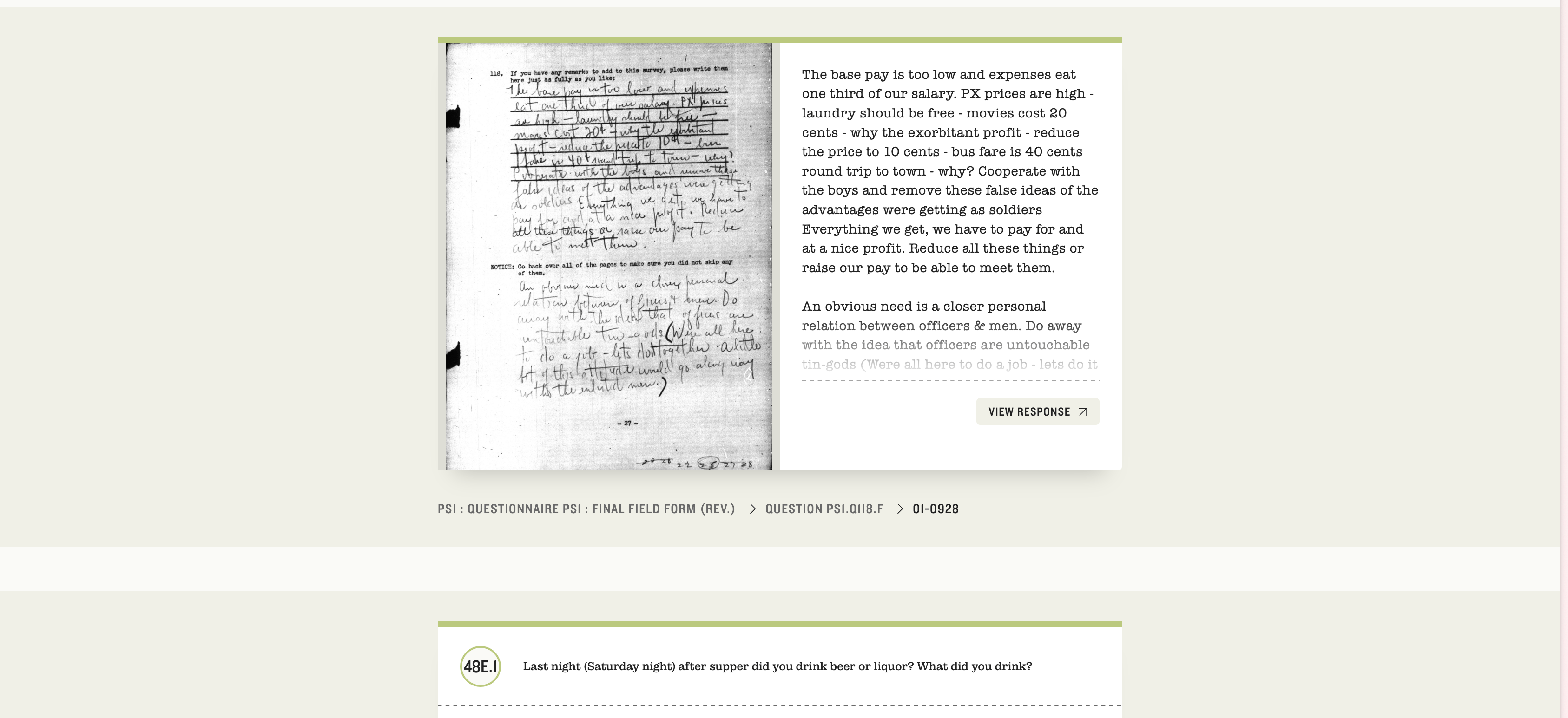
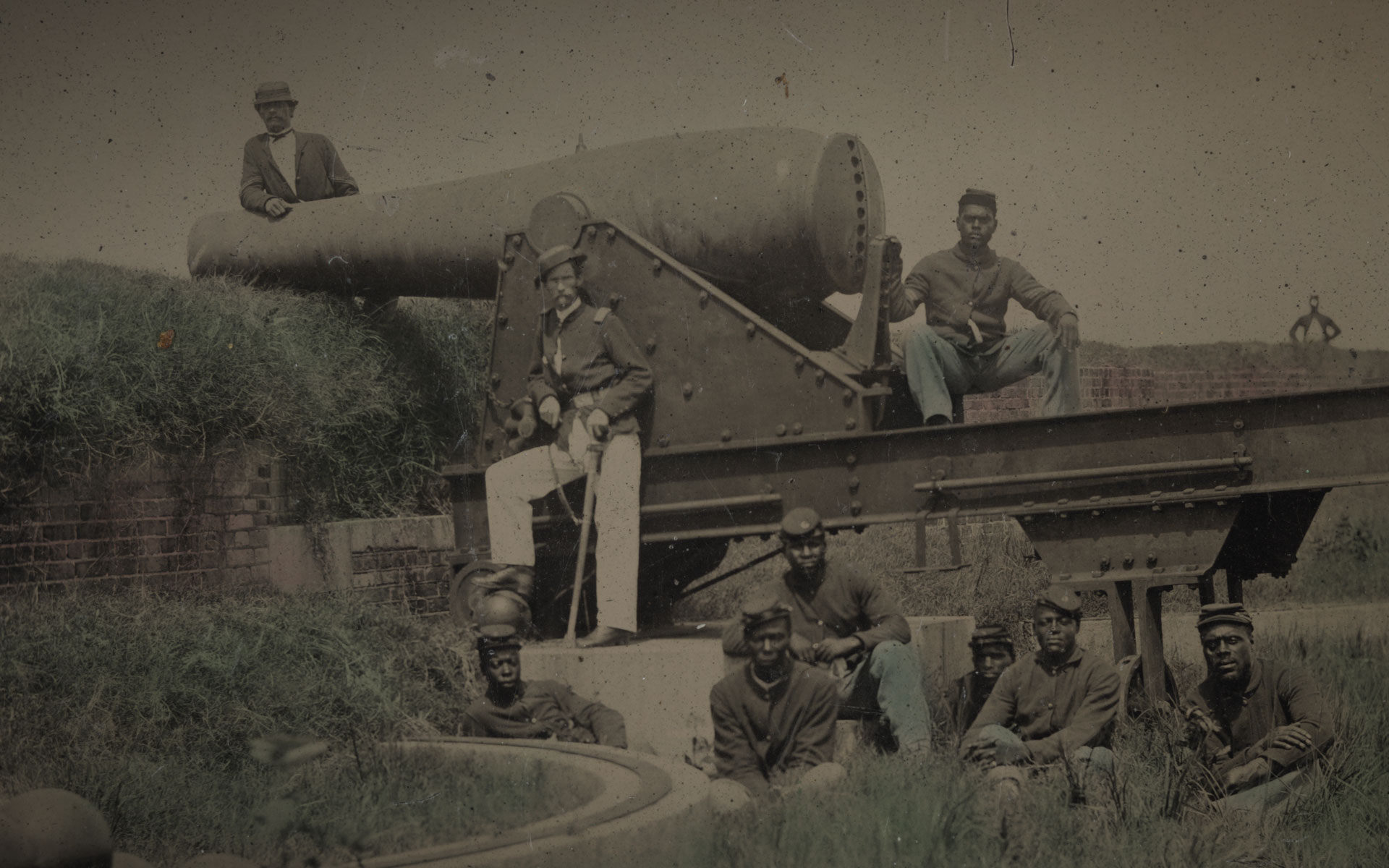
During World War II, the US Army administered more than 200 surveys to over half a million American troops to discover what they thought and how they felt about the conflict and their military service. The surviving collection of studies is now accessible to the public for the first time at The American Soldier in World War II. Browse and search over 65,000 pages of uncensored, open-ended responses handwritten by servicemembers, view and download survey data and original analyses, read topical essays by leading historians, and access additional learning resources.


Reimagines Michael Maier’s 1618 book of allegorical illustrations Atalanta fugiens through a digital edition merging text, music, and image. Users can consult a searchable translation, high-resolution visuals, and specially recorded vocals, alongside scholarly essays.
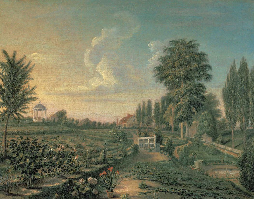
Traces the origins and evolution of U.S. landscape and garden aesthetics through textual and visual sources. Organized around key places, people, and design concepts, HEALD illuminates how terms, styles, and practices shaped early American environments, accompanied by an extensive bibliography.
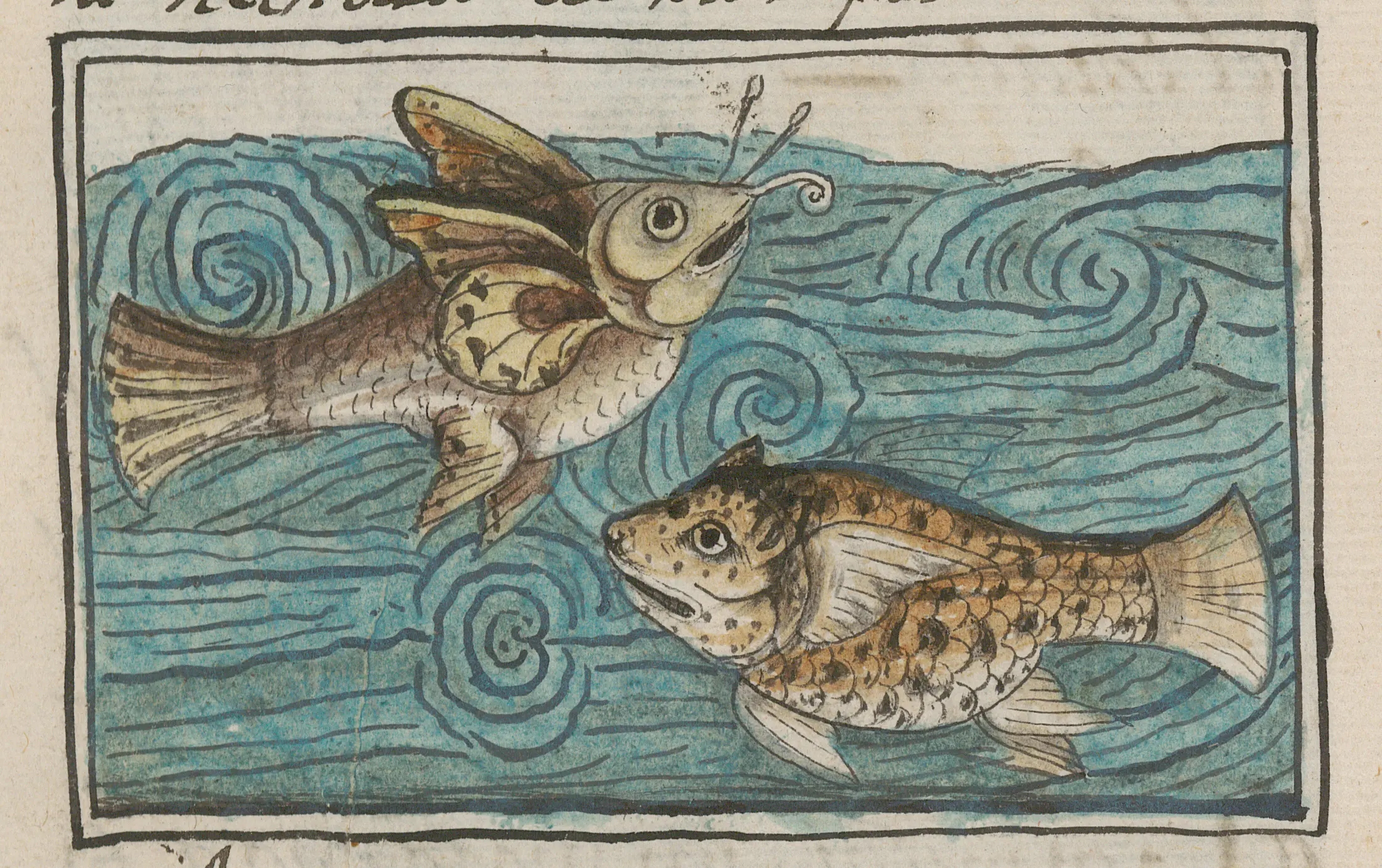
The Digital Florentine Codex gives access to a singular manuscript created by Franciscan friar Bernardino de Sahagún and a group of Nahua elders, authors, and artists. Written in parallel columns of Nahuatl and Spanish texts and hand painted with nearly 2,500 images, the encyclopedic codex is widely regarded as the most reliable source of information about Mexica culture, the Aztec Empire, and the conquest of Mexico. Upon completion in 1577 at the Imperial Colegio de la Santa Cruz in Tlatelolco (today Mexico City), the manuscript was sent to Europe where it entered the Medici family’s library in Florence—thus, the Florentine Codex. This digital edition unlocks the manuscript’s content by making the texts and images searchable.
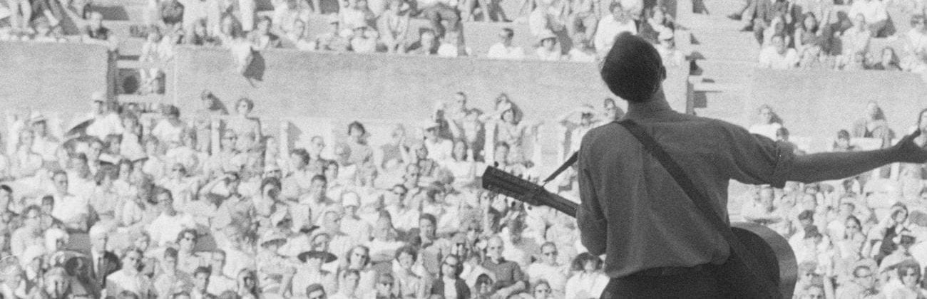
Digital exhibit that explores the Berkeley Folk Music Festival through an archive of 33,500 items, many newly digitized for the first time highlighting broader post–World War II issues of race, class, gender, region, and democracy.

Since 1986, the Princeton Geniza Lab has been studying and digitizing historical documents from the Cairo Geniza, a cache of roughly 400,000 fragments of paper and parchment preserved in a medieval Egyptian synagogue. The lab’s work consists of research, transcription and database design. We've built an open-access database called the Princeton Geniza Project to make geniza documents available to researchers and the interested public. The lab’s work consists of research, transcription and database design. We've built an open-access database called the Princeton Geniza Project to make geniza documents available to researchers and the interested public.
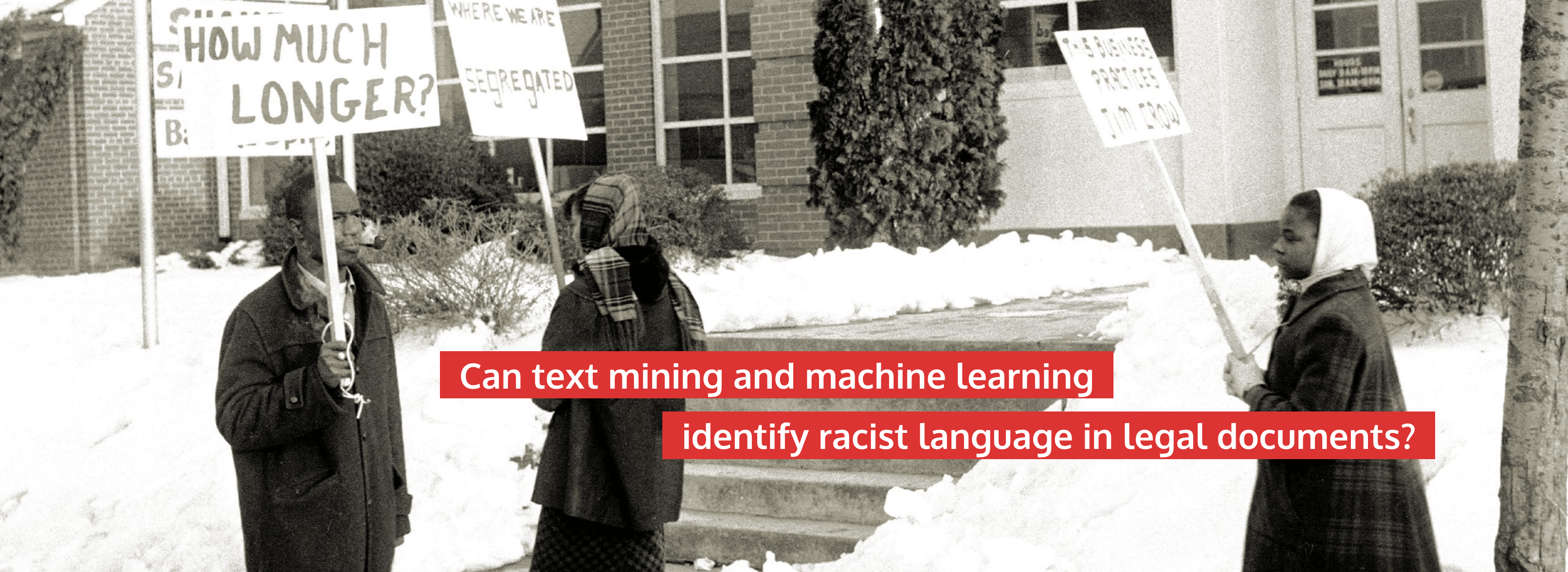
On the Books: Jim Crow and Algorithms of Resistance is a text mining project with the goal of discovering Jim Crow and racially-based legislation signed into law in North Carolina between Reconstruction and the Civil Rights Movement (1866-1967).

We aim to empower people in and of the Pacific Islands, enabling them to see, discover and explore items of digitised cultural heritage that are held in collections around the world. People of the Pacific may not be aware these items or records exist, and we want to support them as they connect with these aspects of their own culture and history.
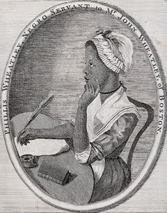
The Winnifred Eaton Archive is a research and teaching tool that offers over 300 works by Winnifred Eaton Babcock Reeve (1875-1954). Winnifred Eaton was a popular early Asian North American author, journalist, screenwriter and playwright...Drawing on the resources of libraries and special collections from around the world, this digital archive provides freely accessible scans and fully searchable transcriptions of much of Winnifred Eaton’s collected oeuvre... It also houses supplemental materials: photographs, reviews, illustrations, a biography, a bibliography, and unpublished manuscripts.
We are a Nairobi based, non profit organization working to encourage a more critical, holistic and knowledge-based approach to digital solutions within African heritage. Through this, we hope to cement the place of African culture in an era of rapidly changing technologies and endless frontiers.
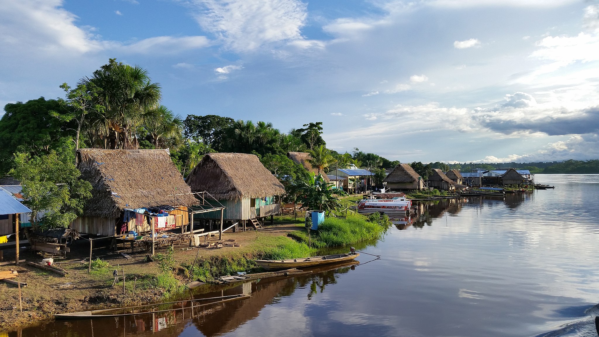
Fusing public anthropology with digital humanities, the Urarina Digital Heritage Project will make use of Indigenous information management systems and cultural protocols to create a digital collection of Urarina cultural heritage and explore issues related to Indigenous digital archives. Working in collaboration with Urarina cultural specialists, the project is dedicated to decolonizing archival practices and modes of access through recognition of Indigenous sensibilities, knowledge practices, and interdictions for the curation of cultural materials—tangible and otherwise. Partnering with scholars and nonacademic members in the United States and Peru, our work aims to facilitate digital spaces for the Urarina communities to maintain, access, narrate, and exchange their digital history and heritage in culturally relevant and ethical ways.

A community-driven platform in Rio de Janeiro’s Maré favela, Cocôzap allows residents to report sanitation issues via WhatsApp. The collected data is then mapped online, spotlighting neglected infrastructure while advocating for improved public policies and underscoring the potential of citizen science in areas often overlooked by state authorities.

A developing architectural tour showcasing the many ways in which Chicago's enduring, protean, at times antagonistic dialogue with classical antiquity has shaped the city's look, reputation, and identity.
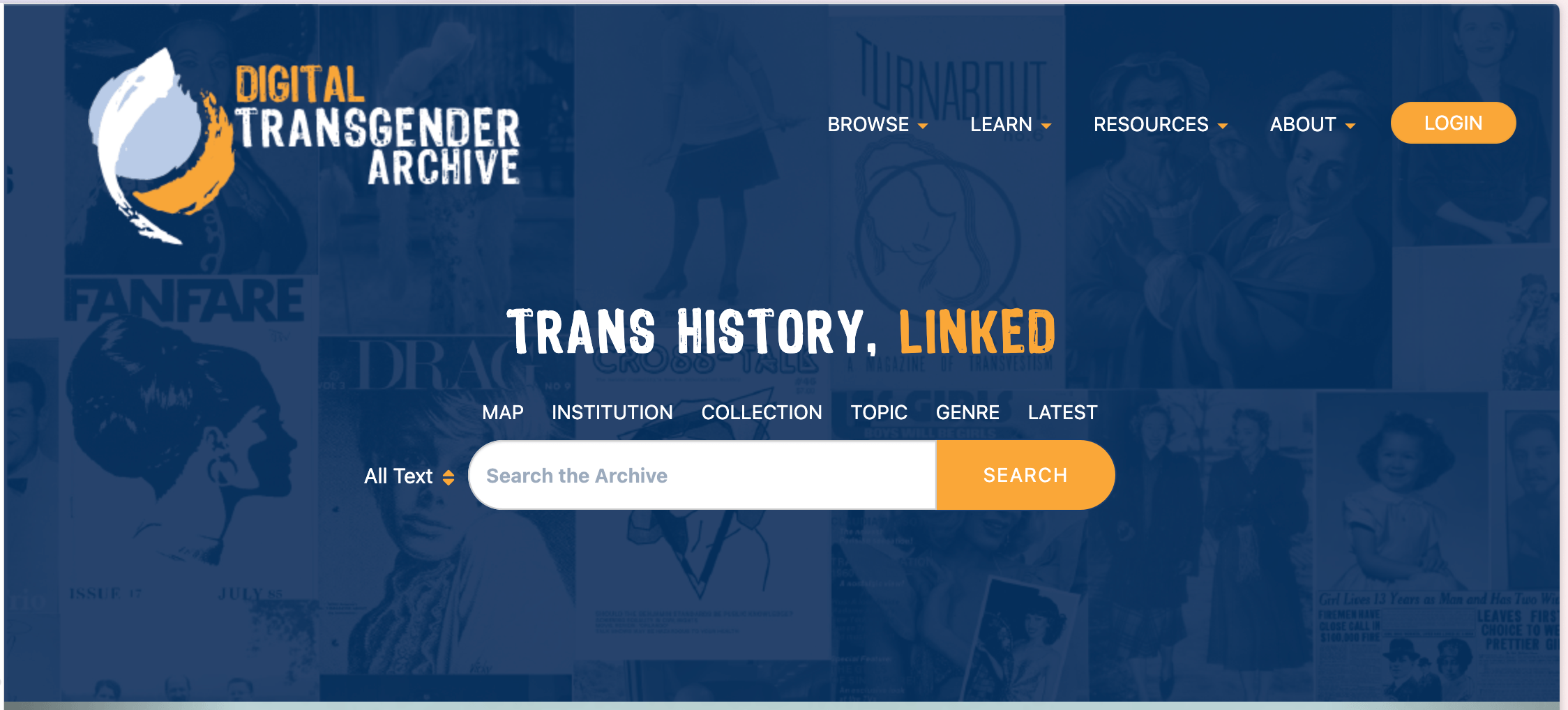
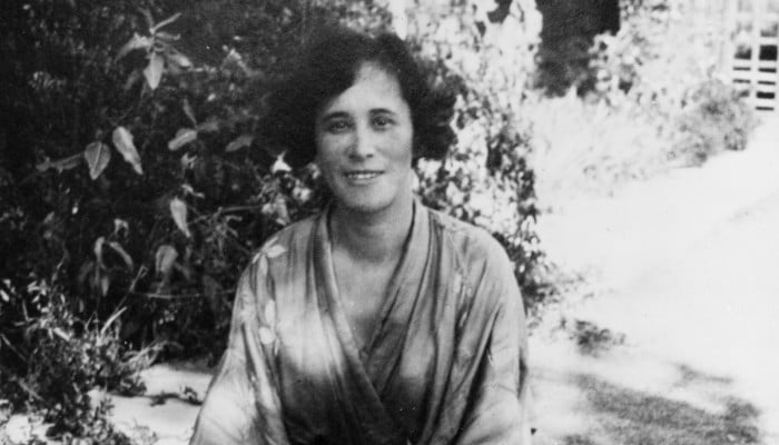
The Digital Transgender Archive compiles transgender-related materials from over 60 institutions globally, focusing on pre-2000 resources—photographs, periodicals, and more. It fosters research, teaching, and public understanding of transgender histories.

Explore Hereford's famous Mappa Mundi & unique medieval treasures. An exceptionally well done interactive digital exhibit of the Mappa Mundi where users can explore the mythical beasts, legends, and cities of this famous map.
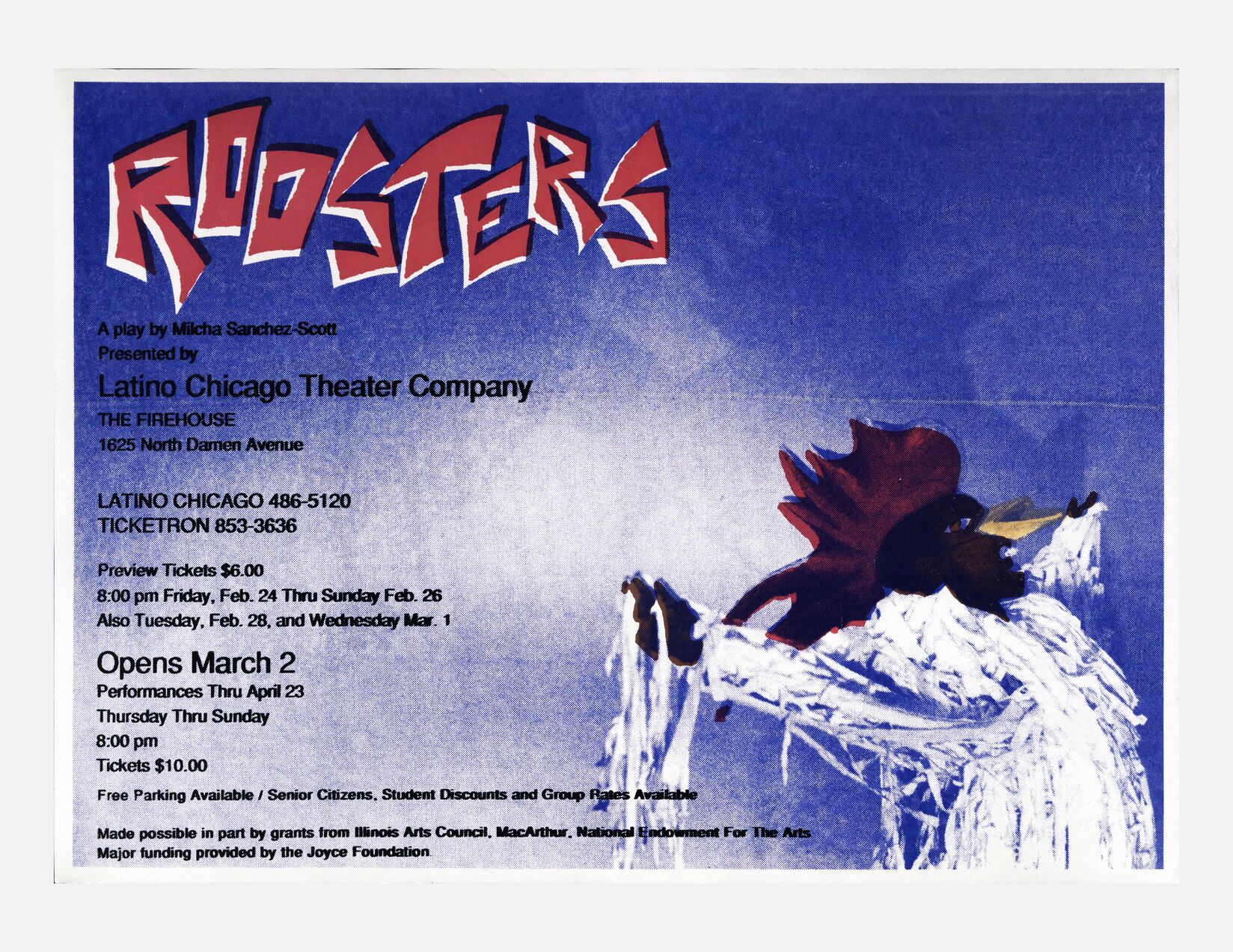
This collection showcases posters, flyers and photographs from the Recovering the US Hispanic Literary Heritage's Hispanic Theater Collection, donated by Nicolás Kanellos. This project was developed by the US Latino Digital Humanities (USLDH) Center at the University of Houston.

GnNM uses machine learning to identify geographic references in historical newspaper texts, allowing researchers to filter data via and visualize changes across multiple maps from 1880 to 1920
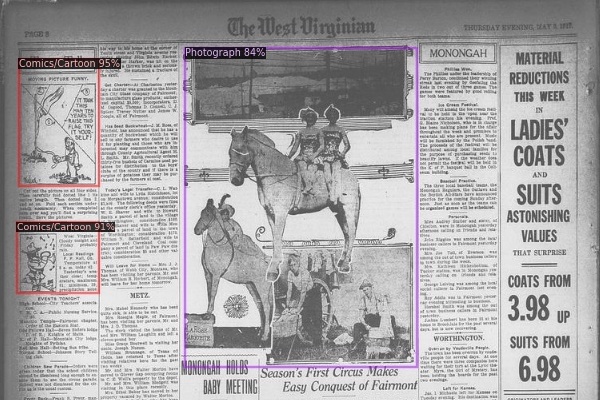
Explore the visual and textual content within the Chronicling America digitized newspaper collection in new ways using machine learning!
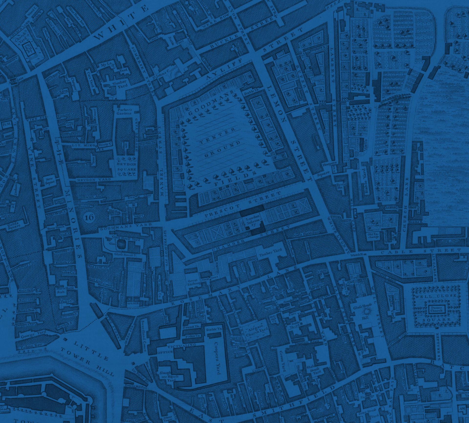
The East End Digital Library is a place to explore digital archives and London literary history, through two separate collections of personal documents, users can explore the cultural history of the East End of London.
Explore The Resemblage Project: a digital storytelling resource for Scarborough's stories of aging through art, community, and intergenerational connection
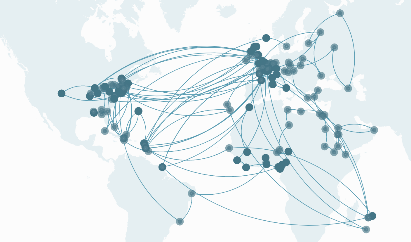
The platform comprises two interactive visualizations that trace the movements of significant cultural actors from the Caribbean and wider Americas, Africa, and Europe within the 20th century Afro-Atlantic world... Same Boats is meant to serve above all as an invitation for our community of researchers, students, and educators to flesh out and enrich the scholarly record toward the constitution of a 20th century Afro-Atlantic Republic of Arts and Letters.
Mapping Marronage is an interactive visualization of the trans-Atlantic networks of intellectual, creative and political exchange created by enslaved people in the 18th and 19th century. It traces the geographic reach, crossings and intersections of letters, testimonies and financial exchanges by enslaved people of African-descent.
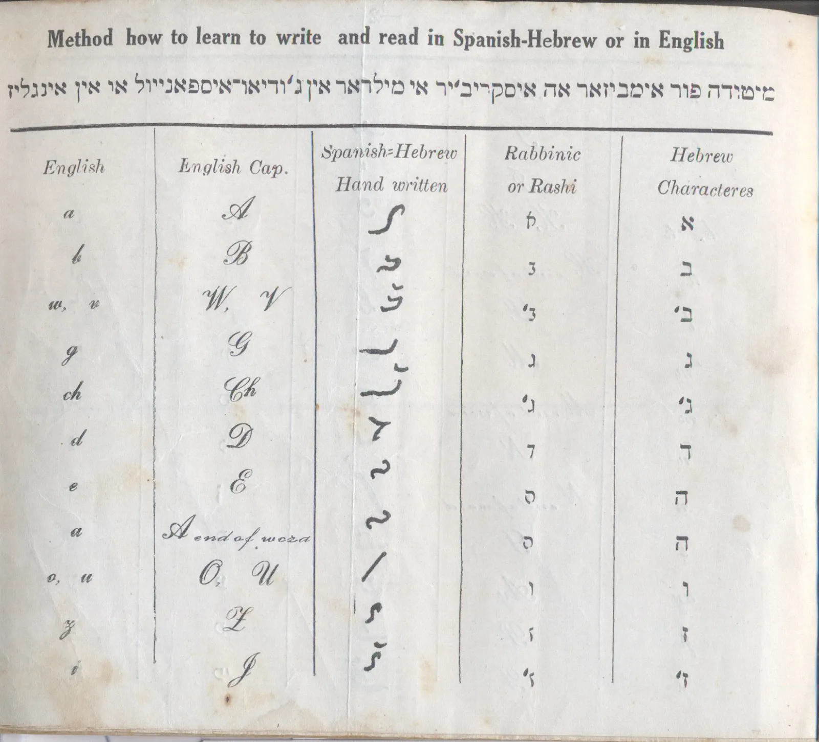
This effort preserves materials in Solitreo, a cursive script used for the Judeo-Spanish language. Unique documents, including letters and diaries, were digitized and made accessible through an online portal, fostering preservation.
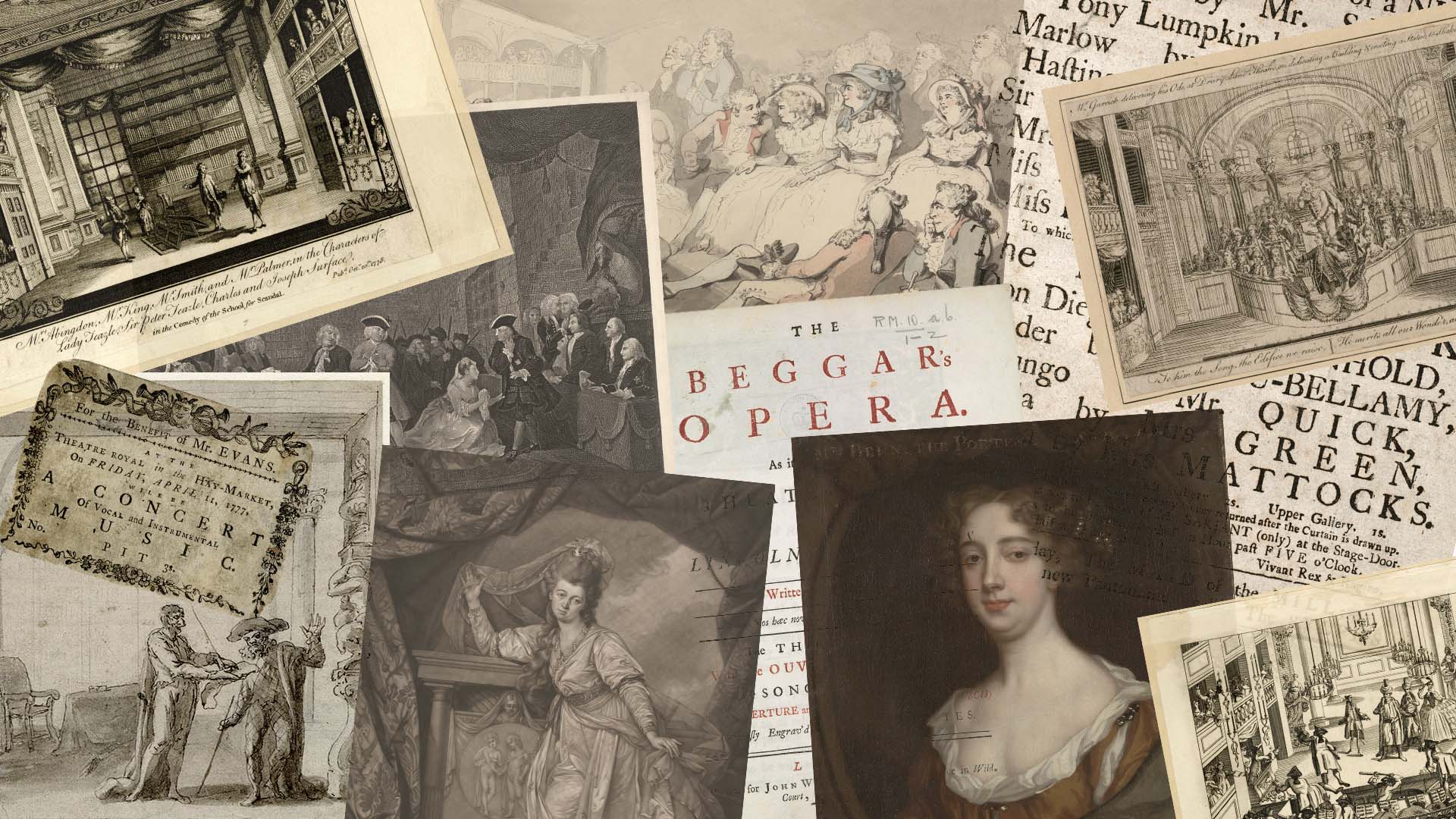
The London Stage Database is the latest in a long line of projects that aim to capture and present the rich array of information available on the theatrical culture of London, from the reopening of the public playhouses following the English civil wars in 1660 to the end of the eighteenth century. On a given night, in each of the city’s playhouses, hundreds or even thousands of spectators gathered to experience richly varied performance events that included not only plays, but prologues and epilogues, short afterpieces and farces, pantomimes, instrumental music, singing, and dancing. These events, taken together, provide a wealth of information about the rhythms of public life and the texture of popular culture in long-eighteenth-century London.
Literature in Context: An Open Anthology of Literature, 1660-1830, is a web-accessible and mobile-friendly digital anthology of curated, contextualized, machine-readable literature in English designed for use by students, teachers, and the general public. Because we anticipate these pieces being used in the classroom, it is essential that the material be authoritative, citable, and printable—therefore, users can create custom coursepacks that live both online and in print. At once an Open Educational Resource and a digital humanities project that seeks to bring to life the literature of the long eighteenth century, Literature in Context also provides resources to help instructors at the college level engage students in the task of editing and annotating literary texts that can be added to the collection. By including students in the production of the anthology, the project will foreground how the public construction of knowledge is essential to understanding the modern world.

Ticha allows users to access and explore many interlinked layers of these texts, including images of the original documents, transcriptions, translations into English and modern Spanish, linguistic analysis (including morphological interlinearization), and commentary. Ticha is innovative in bringing together data analyzed in FLEx (Fieldworks Language Explorer) a system for lexical and grammatical analysis, with current TEI standards (Text Encoding Initiative) for paleographic and translational representations of texts. Ticha seeks to make this corpus of Colonial Zapotec texts accessible to scholars in diverse fields (including linguistics, anthropology, and history), Zapotec community members, and the general public.
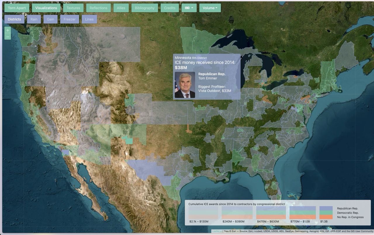
Deep and radically new look at the territory and infrastructure of ICE’s financial regime in the USA. This data & visualization intervention peels back layers of culpability behind the humanitarian crisis of 2018

The World Historical Gazetteer is a platform for linking records about historical places, allowing people to make spatial connections across time and language.

A digital resource for locating and studying handwritten inscriptions of the early Roman empire. These ancient messages and sketches offer a window into the daily life and interests of the people who lived in the ancient world, especially in Herculaneum and Pompeii. They provide perspectives on Roman society, the ancient economy, religion, spoken language, literacy, and activities within the ancient city.

This initiative makes South Africa’s Truth and Reconciliation Commission (TRC) archives more navigable through digital tools like natural language processing and machine learning
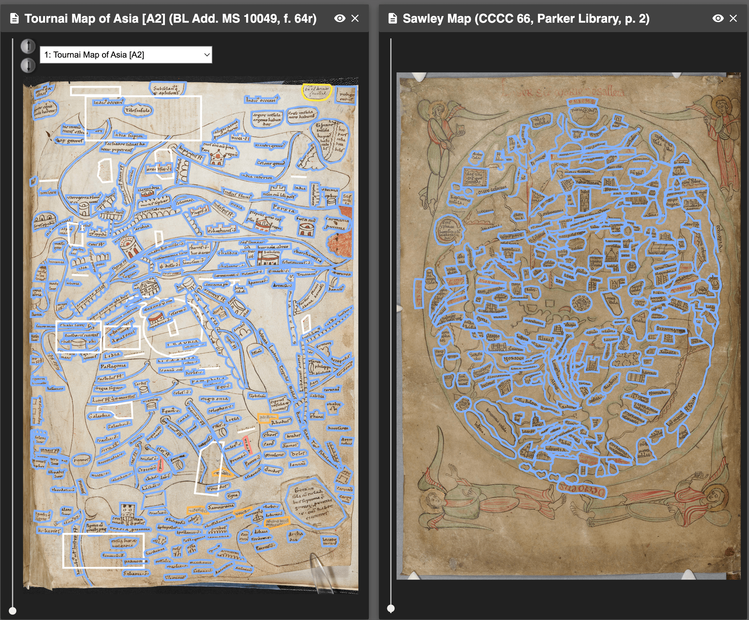
Welcome to Virtual Mappa, an ongoing set of networked digital editions of medieval maps, published as open access scholarship, and undertaken in collaboration with the British Library, and hosted by the Schoenberg Institute for Manuscript Studies. Each map edited in the project is available as a digital image, with every inscription many other features of interest highlighted, and linked to an annotation that includes a transcription, translation, and additional notes.

Taking account of seasonal variation and accommodating a wide range of modes and means of transport, ORBIS reveals the true shape of the Roman world and provides a unique resource for our understanding of premodern history.
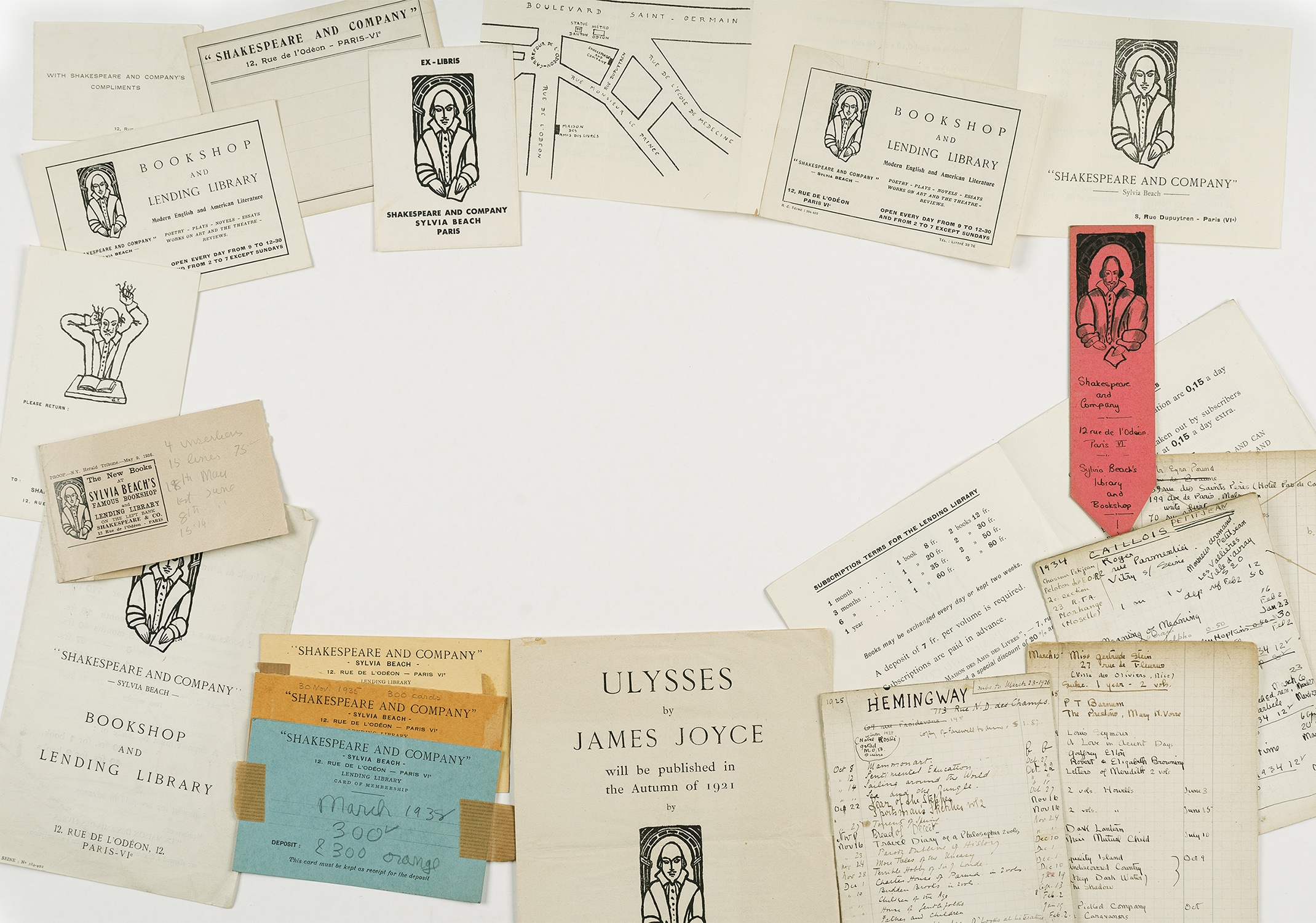
Recreating the world of the Lost Generation in interwar Paris
Explore or reconstruct the lives of individuals who were enslaved, owned slaves, or participated in the historical trade.

Viabundus is a freely accessible online street map of late medieval and early modern northern Europe (1350-1650). Originally conceived as the digitisation of Friedrich Bruns and Hugo Weczerka's Hansische Handelsstraßen (1962) atlas of land roads in the Hanseatic area, the Viabundus map moves beyond that. It includes among others: a database with information about settlements, towns, tolls, staple markets and other information relevant for the pre-modern traveller; a route calculator; a calendar of fairs; and additional land routes as well as water ways.
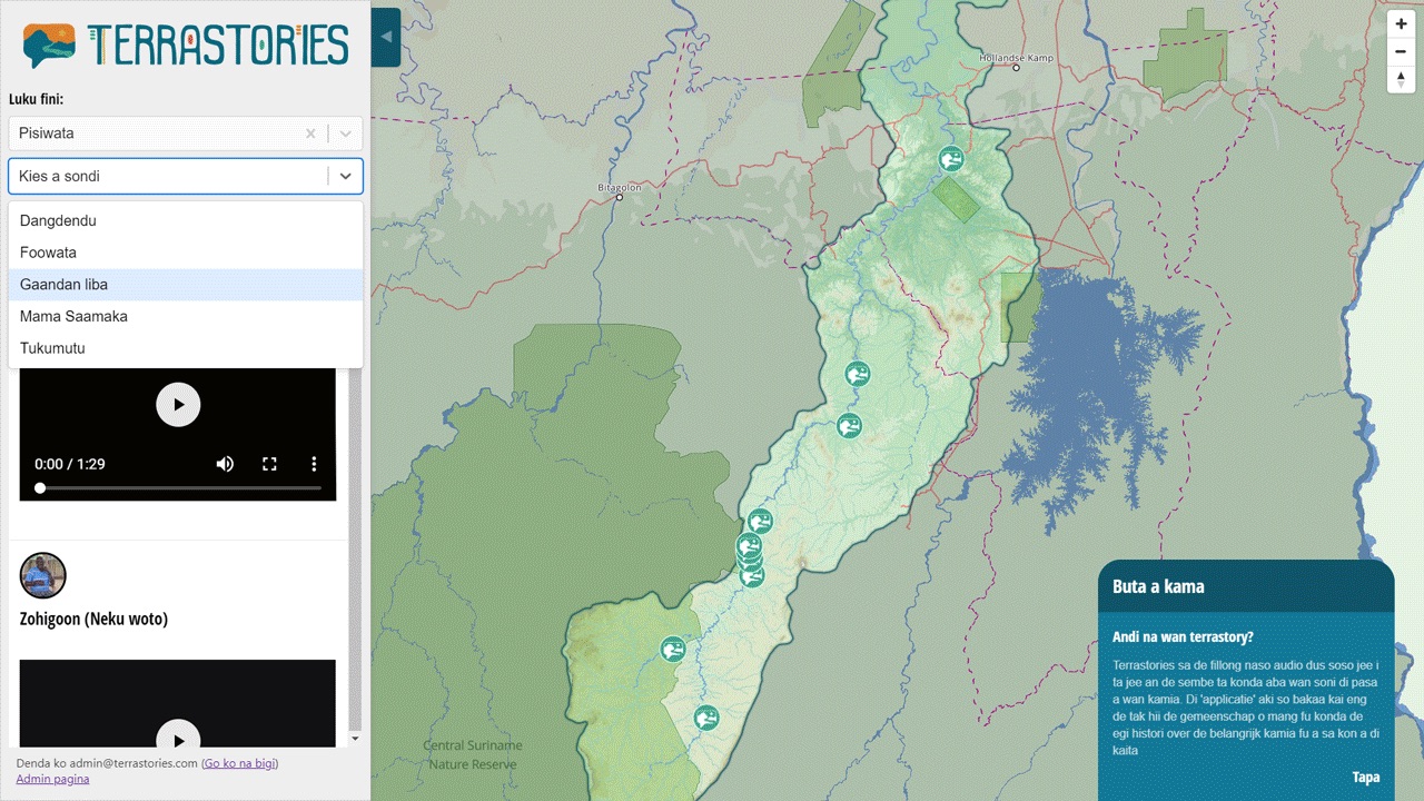
Terrastories is a geostorytelling application built to enable indigenous and other local communities to locate and map their oral storytelling traditions

Pleiades gives scholars, students, and enthusiasts worldwide the ability to use, create, and share historical geographic information about the ancient world in digital form. Pleiades has tens of thousands of community sourced entries on ancient peoples and places.
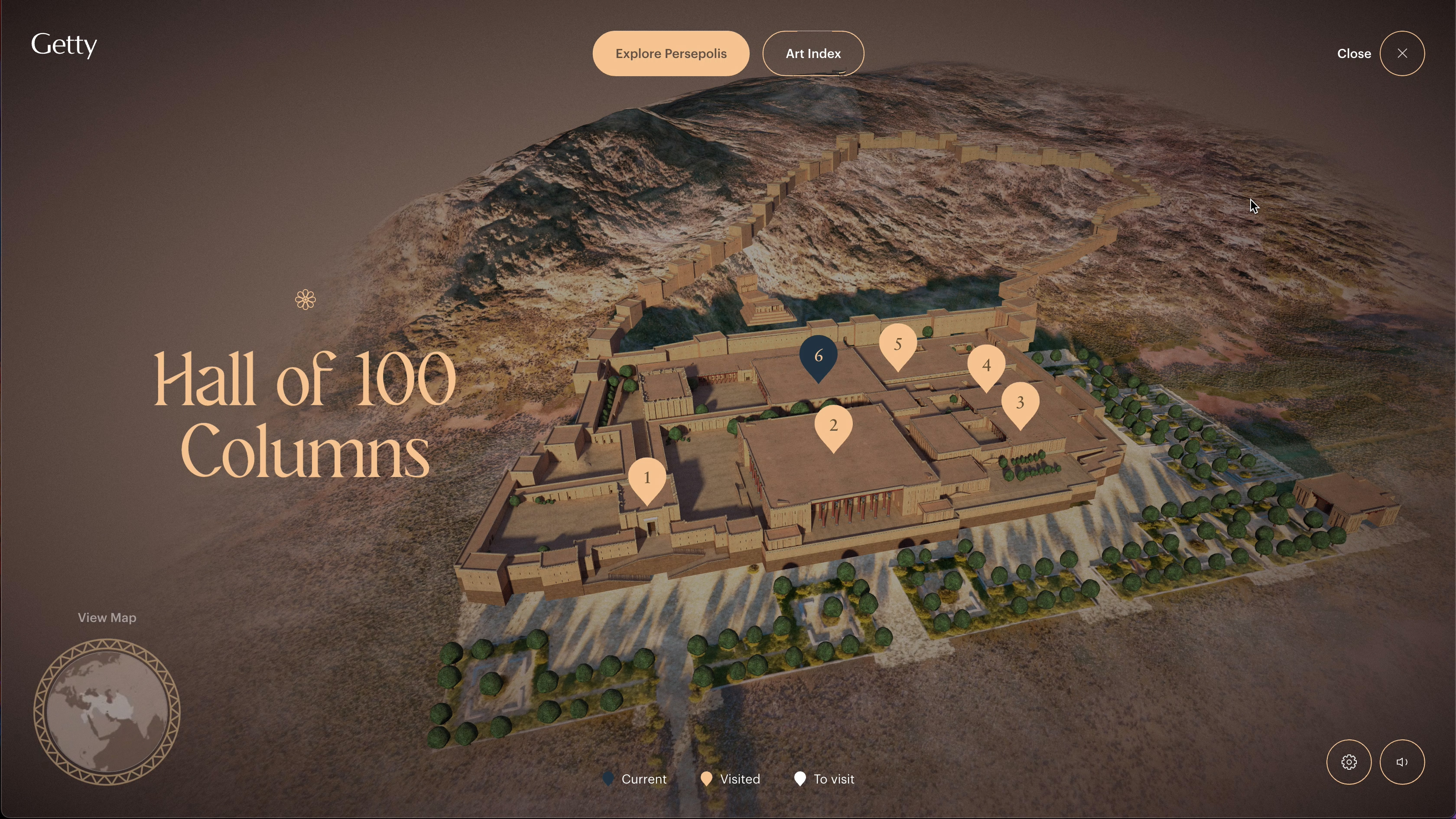
Persepolis Reimagined is the result of a collaboration between historians, creatives, and technologists, in the context of the Getty Villa Museum exhibition, Persia: Ancient Iran and the Classical World. Phenomenal interactive exploration of the ancient city of Persepolis, using a 3D model of the city and it's landmarks.
Welcome to Scribes of the Cairo Geniza, your chance to work with others to unlock the secrets of one of the greatest archives of the middle ages. Hidden for centuries in an attic in Cairo, over 300,000 fragments of pre-modern and medieval Jewish texts—from everyday receipts to biblical works—have yet to be fully deciphered.

Who has never imagined walking alongside species that were once contemporary with humans, but are now extinct? This augmented reality journey brings back to life species of animals that are extinct or endangered today. The dodo, great sabre-toothed tiger, Steller's sea cow, the elephant-bird or Tasmanian tiger, like 3-dimensional holograms, these fascinating species come back to life before your eyes. But then how did they live and what were the causes of their extinction?

The CFRP exemplifies the potential of digital humanities projects by providing a data-driven approach to theatre history. It contains digitized collections of 18th-century France theater performances and offers a unique online archive that allows users to explore historical data through search and visualization tools.

This platform documents massacre sites involving Aboriginal and non-Aboriginal people across Australia from 1788 to 1930. Through mapped incident details—including victim numbers and language groups—it fosters broader awareness of historical violence and plays a role in informing discussions about Indigenous affairs.
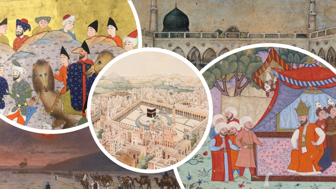
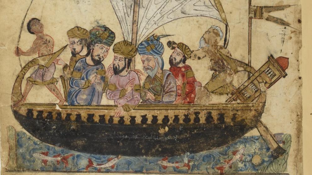
The annual Hajj pilgrimage to Mecca is one of the five pillars of Islam and incumbent upon all able-bodied Muslims once during their lifetimes. It was arguably the largest seasonal migration of people in the early modern world from year to year bringing people together from as far apart as West Africa to Southeast Asia...The purpose of this educational historical simulation is to bring students along that same journey and understand how the hajj fit into the larger social, political, and cultural world of the Ottoman Empire and beyond.
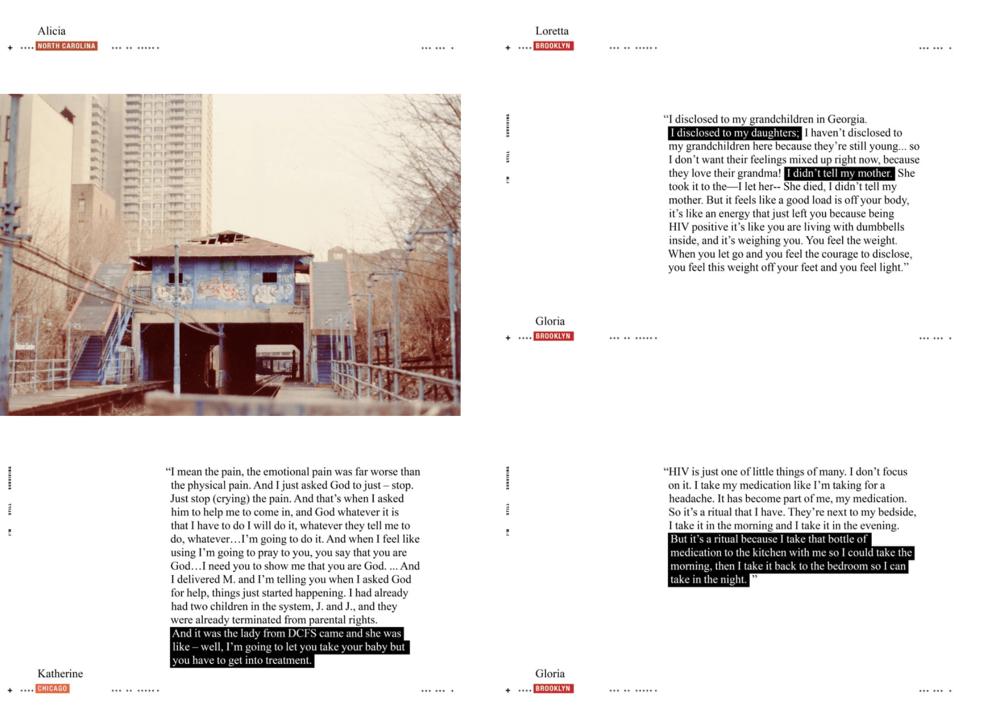
An interactive digital exhibition centering the narratives of women living with HIV/AIDS in Brooklyn, Chicago, and the Raleigh-Durham area. Developed through a community-based approach, it presents text, and visual materials of firsthand accounts, spotlighting challenges and resilience in the broader history of HIV/AIDS.
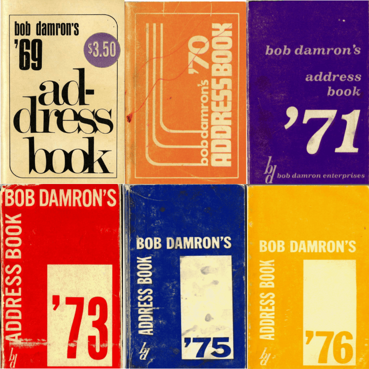
Mapping the Gay Guides (MGG), is a collaborative mapping project by Dr. Amanda Regan and Dr. Eric Gonzaba that draws on the Damron Guides, an early but longstanding travel guide aimed at gay men since the early 1960s.
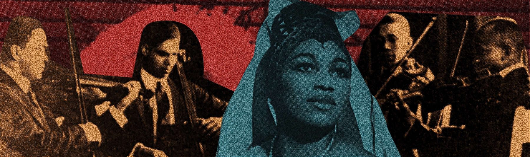
A Harvard-based digital exhibition celebrating musicologist Eileen Southern, a pioneering scholar of African American music. It offers a multimedia biography, timeline, and interactive map of Southern’s life, all curated to deepen public awareness of her scholarship and intellectual legacy.

For teachers and scholars, Readux provides a user-friendly way to publish critical editions as a stand-alone website and to develop interactive classroom projects. Think of it as a digital reading room where you can browse, search, and take notes in rare materials, then click a button to create a website with your personalized edition for personal and professional scholarly use.

Welcome to the Princeton Prosody Archive, a full-text searchable database of thousands of digitized books in English published between 1532 and 1928. The Archive collects historical documents and highlights discourses about the study of language, the study of poetry, and where and how these intersect and diverge...Rather than a static repository of historical data, the PPA compels users to rethink the past and future of organizing, navigating, conceptualizing, and historicizing large amounts of data—about a single poem or about evolving and contradictory thinking about the technology of poetic language.
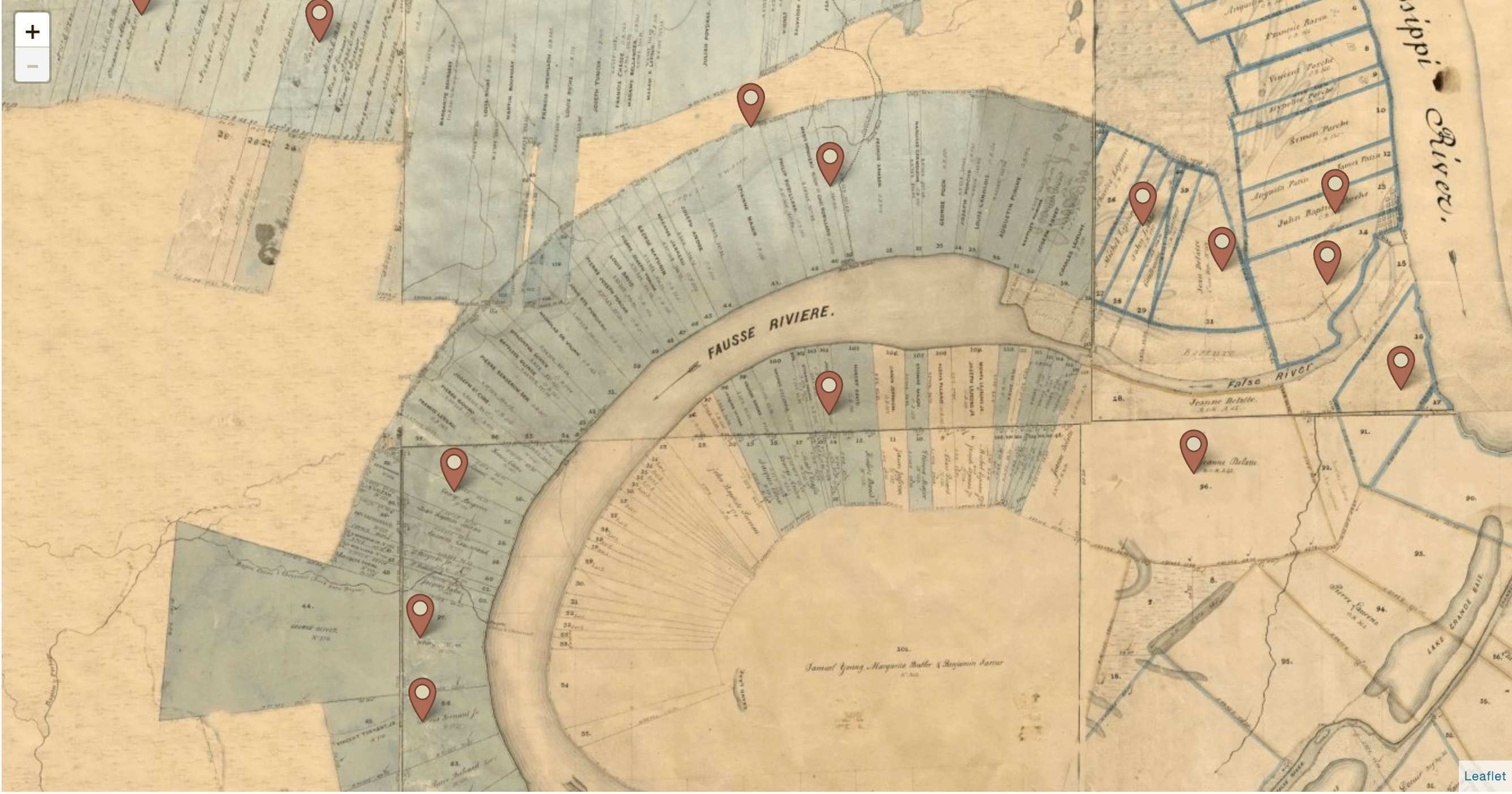
In April 1795, a number of slaves were arrested at Pointe Coupée for planning a revolution. Their idea was to set fire to a shed on the Julien Poydras estate. Lying in wait, they would ambush the whites who came to extinguish the fire and then travel from plantation to plantation, killing their former masters and gathering other slaves to join the revolt. The Louisiana Slave Conspiracies is an innovative project offering an interactive map and searchable databases, it allows users to explore the events, people, and places associated with the 1791 and 1795 conspiracies in a non-linear fashion.

In the exhibition On the Map, visitors get to draw their own unique journals, showing the ideas and intentions of map makers while becoming part of the tradition themselves...The exhibition starts as visitors take a journal. As they move through the space they’re asked a series of questions, which they can answer through writing or drawing. At the end of the exhibition, these journals are scanned, and their answers projected life-sized on the cube. This way, visitors can be inspired by one another as they create a collaborative, three-dimensional map.
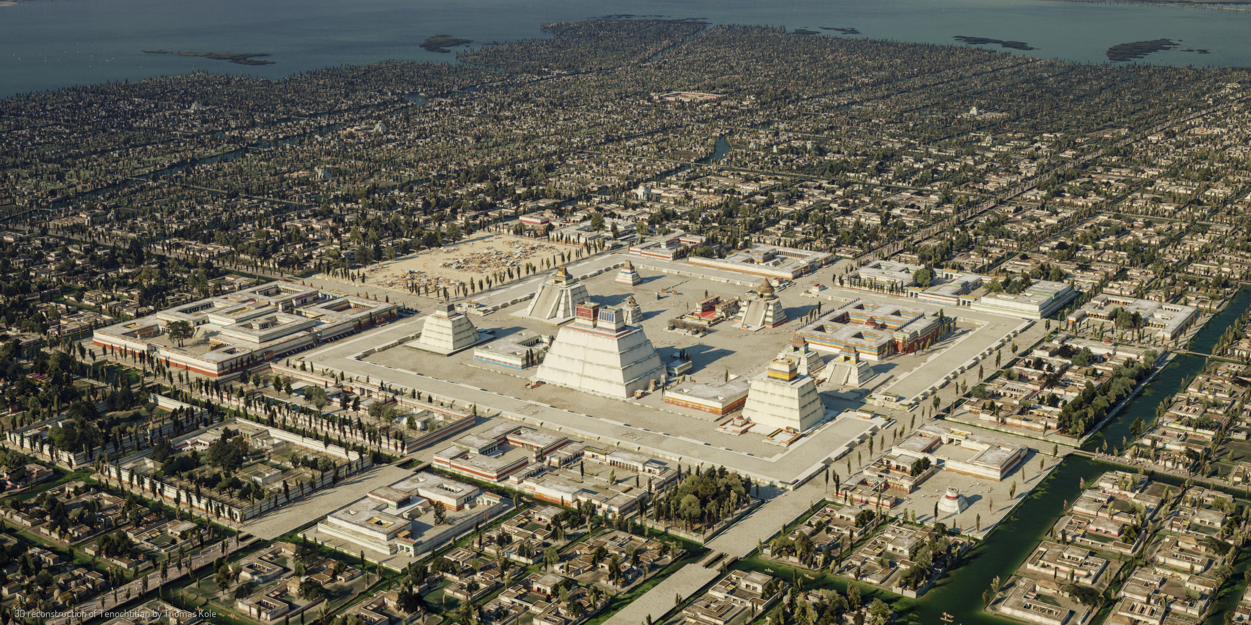
Not much is left of the old Aztec - or Mexica - capital Tenochtitlan. What did this city, raised from the lake bed by hand, look like? Using historical and archeological sources, and the expertise of many, I have tried to faithfully bring this iconic city to life.
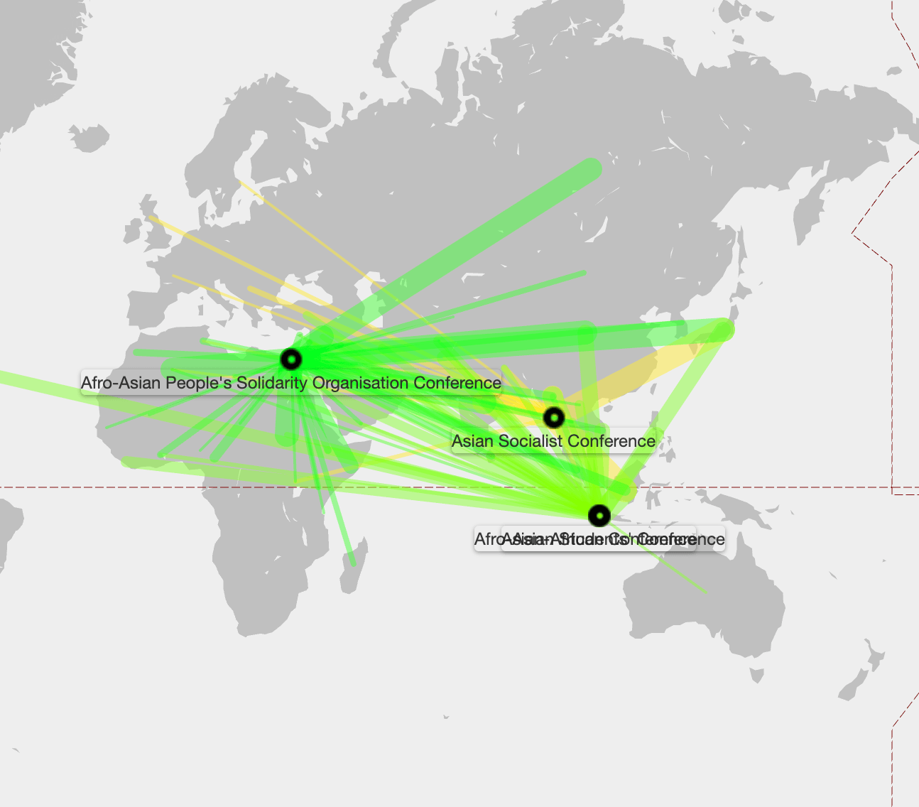
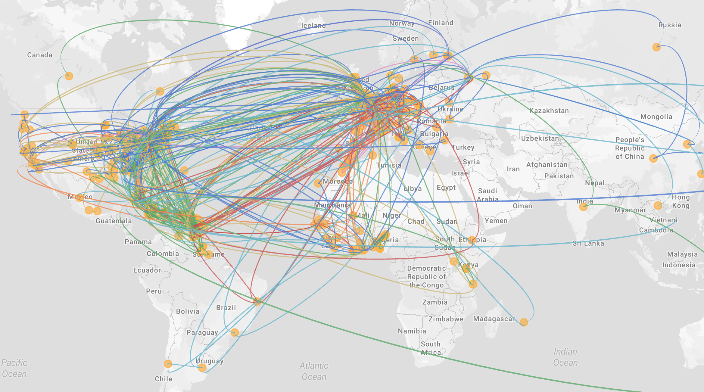
Uses data visualization to trace the movements of individuals attending multiple Afro-Asianist conferences during the Cold War. Allows users to cross-reference events, track mobilities, and analyze how non-state actors interacted in various geopolitical contexts related to decolonization and international collaboration.
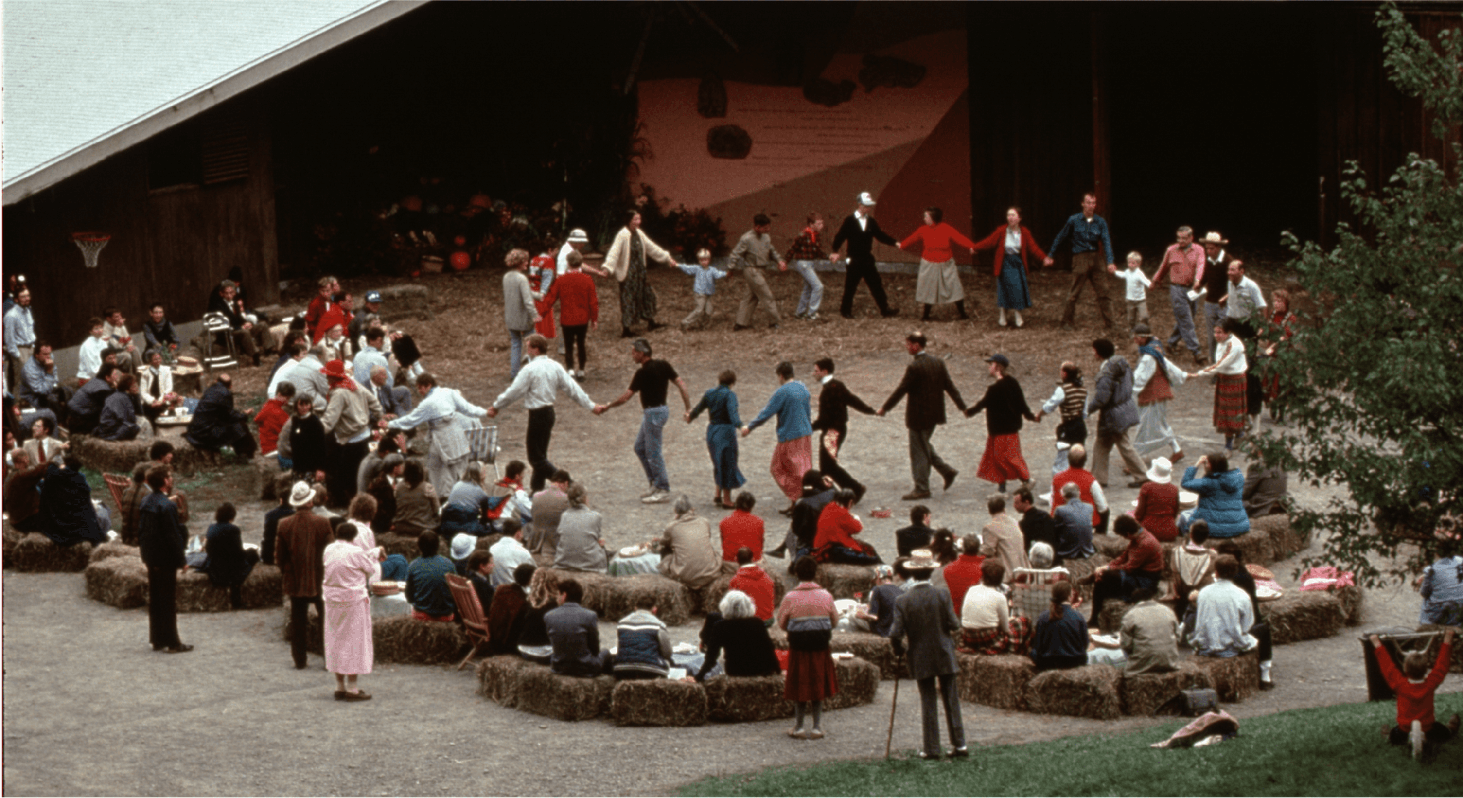
A study of the Camphill movement’s inclusive living communities, this project employs GIS to visualize the the communitie’s origins and spread. Grounded in archival research, it provides a captivating narrative of the movement’s growth and impact.
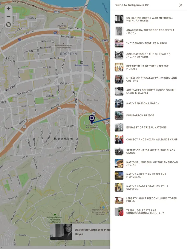
Guide to Indigenous DC is a walking tour map featuring sites of importance to Native peoples across the Nation’s capital. The Guide emphasizes Indigenous peoples’ contributions to Washington, DC, highlights the historical and contemporary federal tribal policy developed in the city, and acknowledges the peoples whose homelands upon which the District of Columbia was built. The Guide showcases the empowering stories of how Washington, DC is a place of tribal history, gathering, and advocacy with a long, rich history.